


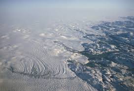
Using NASA satellites, University of Wisconsin researchers were able to measure the impact of the cloud coverage over Greenland’s melting ice sheet and predict how it could affect the future.
For a long time people have known cloud coverage serves as a blanket that retains Earth’s heat and energy, making the surface of the earth warmer, Tristan L’Ecuyer, atmospheric and oceanic sciences associate professor, said.
But it’s not the blanket itself that’s necessary to understand, but the impact that blanket can have on current and future climate changes, like rising sea levels, he said.
After collecting information for five years from two NASA satellites orbits, L’Ecuyer co-authored a study analyzing the cloud coverage above Greenland’s ice sheet to determine how much sea levels will rise in the future.
The cloud properties in the Arctic and Antartica have only recently been able to be observed and measured, Elin McIlhattan, atmospheric and oceanic sciences graduate student, said.
One reason for this is because the measurements of the clouds, usually taken from the ground, couldn’t be taken because few people live in Greenland to record cloud measurements, L’Ecuyer said.
Additionally, because of the cold temperatures of the overhead clouds in the arctic and the cold surface of the earth, previous satellites were unable to measure the clouds’ properties, McIlhattan said.
“[The older] satellites are kind of like a camera without the flash; they can’t really tell [us] what’s in the cloud, the thickness of the cloud or all of the properties [we] are really looking for,” she said.
The NASA satellites L’Ecuyer and his team used, on the other hand, were able to scan the clouds, effectively taking X-ray images that enabled researchers to determine what the clouds looked like as if they were standing directly on Greenland’s ice sheet.
Analyzing the data the satellites were able to collect, L’Ecuyer and his team were able to compile the data to create an updated model of how Greenland’s melting ice sheet would potentially affect climate change.
“About one-third of rising sea levels on Earth come from Greenland’s quickly melting ice sheet,” L’Ecuyer said. “It’s putting a lot of water into the ocean of what used to be on top of the planet … so important to understand how much sea level will increase in the future.“
NASA’s satellite observations are essential in making sure prediction models are accurate because prediction models are then used by policy makers to plan for changes in climate, McIlhattan said.
Scientists are constantly working to keep the data updated so these prediction models reflect these changes, McIlhattan said.
Satellites use algorithms written by scientists and programmers to interpret the data modelers use to create predictions of the future, McIlhattan said. Neither community has perfect, absolute answers to what’s going on in our climate system, McIlhattan said, but if they continually work together both sets can be improved.
“If the computer models are doing a good job today, then we will have a lot more confidence that the models are going to be able to predict whats going to happen in the future,” L’Ecuyer said.